Detect, Avoid, and Trust: Why Legacy Models Fall Short in Low‑Altitude BVLOS Airspace
AI Analysis
The article discusses the challenges of integrating unmanned aircraft systems (UAS) beyond visual line of sight (BVLOS) into low-altitude airspace, highlighting the inadequacies of legacy models for collision avoidance and airspace management. It emphasizes the need for a trusted low-altitude air domain awareness system to ensure safety and public trust in the expanding drone economy.
Key Takeaways
- Legacy airspace management models are inadequate for low-altitude BVLOS operations.
- There is a need for a trusted low-altitude air domain awareness system.
- Current systems lack the capability to handle the complexity and diversity of low-altitude airspace.
- The FAA's federated cooperative model requires a tactical level for real-time coordination.
- Sensor-centric detect-and-avoid systems have limitations in low-altitude environments.
Why It Matters
The strategic significance lies in the necessity to adapt airspace management systems to accommodate the growing number of UAS operations, which are critical for future economic activities like drone delivery and emergency response. Without effective systems, there is a risk of increased airspace disruptions and loss of public trust, potentially stalling advancements in drone technology and applications.
The convergence of pending routine unmanned aircraft system (UAS) beyond visual line of sight (BVLOS) integration, the FAA’s surprise homeland security driven “mobile asset” temporary flight restriction (TFR) NOTAM,1 the rapid counter UAS (C-UAS) expansion, and heightened public scrutiny following unresolved drone sightings and high visibility airspace disruptions has amplified the need for trusted low altitude air domain awareness. The 2024 surge in drone sightings in New Jersey2 3 and the February 2026 El Paso airspace and airport shutdown, triggered by counter UAS activity near a major commercial airport, both faced conflicting explanations from the federal government.4 5 6
This rapid escalation of uncertainty regarding airborne objects, their operators, and the authorities responsible for action had significant safety, medical, and economic repercussions.7 Consistent reporting has underscored that inconsistent information, fragmented authorities, potential data misuse,8 and opaque decision making erode public trust in the safety and stewardship of the NAS.9 As C-UAS systems proliferate through federal grant programs10 and expanded statutory authorities, the absence of a shared, trusted, and aviation safe air domain awareness picture at low altitude increases the likelihood of precautionary shutdowns, misidentification events, and reactive regulatory responses.11
In this environment, public faith in the low altitude economy, spanning drone delivery, emergency response, infrastructure inspection, and future advanced air mobility (AAM) concepts, depends not only on preventing collisions, but on providing credible, transparent, and authoritative awareness of what is operating in the airspace and why.12
For decades, coordination, collision avoidance and separation assurance concepts were developed around a relatively small number of cooperative, crewed aircraft operating along predictable routes, at standardized altitudes, and under continuous air traffic control oversight. Those assumptions no longer hold. Under Part 108 and related regulatory initiatives, the National Airspace System is being asked to accommodate large numbers of small, highly maneuverable aircraft operating beyond visual line of sight, often near crewed aircraft and in environments where traditional surveillance and communications infrastructure is limited or absent.13
Domain awareness, aircraft coordination and collision challenges in the emerging low‑altitude and beyond visual line of sight (BVLOS) environment are not scaled‑down versions of traditional crewed aviation risk, they are categorically different. The assumptions that underpin “see and avoid” and its technological analogs were forged in an airspace characterized by altitude stratification, predictable traffic flows, professional pilots, and centralized air traffic control. None of those assumptions reliably hold below 1,000 feet AGL.14
Low‑altitude airspace will be increasingly dense, heterogeneous, and operationally chaotic. It includes crewed aircraft operating under visual flight rules (VFR), public safety helicopters, agricultural aircraft, military training flights, gliders, balloons, and an expanding population of unmanned aircraft systems (UAS), all with widely varying performance characteristics and equipage mandates.15 Traffic density here is episodic rather than continuous and largely scheduled, driven by weather, on-demand emergency response, infrastructure inspection cycles, and commercial demand spikes.
In such an environment, the absence of a persistent, trusted low altitude air domain picture complicates not only real time safety management, but also the FAA’s ability to retrospectively assess reported drone sightings, determine operator compliance, and distinguish lawful operations from unauthorized or malicious activity. Unlike controlled airspace, separation is not assured by procedural design, it is emergent and fragile.16
Those who assume that the low‑altitude economy will ultimately be organized into rigid, trajectory‑based flows are not engaging with the operational reality of the airspace they seek to regulate. That view abstracts away the broad spectrum of commercial, private, and public safety missions that define low‑altitude operations, including air ambulances diverting without notice, law enforcement aircraft responding to unfolding events, agricultural flights tied to weather and terrain, recreational aviation, infrastructure inspection, and an emerging diversity of UAS missions that are inherently opportunistic rather than scheduled.17
The belief that this complexity can be safely compressed into orderly corridors reflects a theoretical construct, not lived experience. One only needs to observe our ground transportation system to see the glaring flaw in this assumption: for more than a century, an extraordinarily diverse mix of vehicles, users, purposes, and performance characteristics has safely coexisted on roads not through rigid trajectories, but through shared rules, mutual awareness, dynamic negotiation, and layered safety mechanisms. Low‑altitude airspace is no less diverse, no less dynamic, and no more amenable to being engineered into tidy flows simply because it is airborne rather than terrestrial.
In traditional, higher-altitude airspace, most flights operate within a largely “directive” management framework. This framework is tightly controlled through centralized services, where separation assurance is primarily provided by external authorities and standardized procedures.
In contrast, in the FAA’s federated cooperative model for the future low‑altitude airspace, airspace management is structured around two familiar layers: Strategic (preflight route planning, area reservation, and 4‑D trajectory deconfliction for approvals) and Operational (timely inflight coordination and communication of mission-driven changes when “no plan survives first contact with reality”). The operational layer handles emergent deviation requests that are relatively few compared to the totality of traffic managed in traditional controlled airspace.
But because the FAA’s low‑altitude approach is cooperative rather than directive and depends on electronic conspicuity among diverse and dynamic use cases (e.g., drone as a first responder DFR), it necessitates a third, Tactical level: a last‑defense, real‑time capability to coordinate and deconflict when unexpected situations and human deviations arise, such as when cooperative aircraft deviate and become collision threats or when non‑cooperative aircraft must also be accommodated. This level requires low‑latency, highly reliable communications and risk calculation that traditional systems do not provide.
BVLOS operations amplify these risks. Once the pilot or remote operator is removed from direct visual contact, coordination and collision avoidance becomes a mediated function of sensors, networks, displays, and human‑machine interfaces. The prevailing regulatory and industry response has been to pursue increasingly sophisticated onboard and offboard Detect and Avoid (DAA) sensors like radar, electro‑optical/infrared (EO/IR), acoustic, radio frequency (RF), ADS‑B In, ground‑based surveillance, and networked traffic services.18 The implicit assumption is that if sensors are good enough, safety will follow.19
Operational experience from both crewed and uncrewed aviation consistently reveals structural limitations in sensor‑centric detect‑and‑avoid (DAA) and cooperative surveillance systems when applied to low‑altitude airspace. These limitations are not isolated anomalies but recurring characteristics of the operating environment in which BVLOS operations are expected to scale.
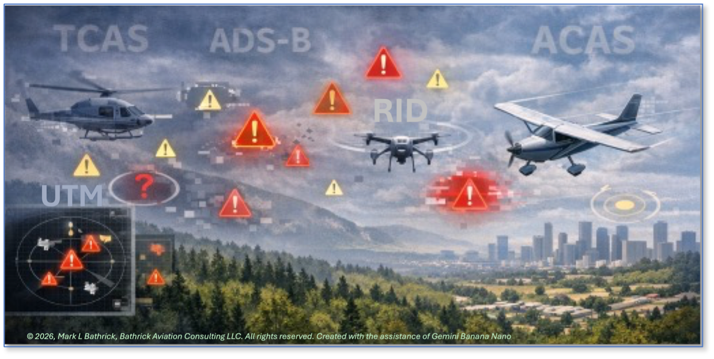
Cooperative surveillance systems such as TCAS, ACAS, and ADS-B depend fundamentally on the presence of compliant, transmitting aircraft. In low‑altitude Class G airspace, that assumption routinely fails. Many crewed aircraft, particularly helicopters, gliders, agricultural aircraft, and public aircraft operating under special authorizations, either lack transponders or operate under equipage exemptions. Small uncrewed aircraft, meanwhile, are generally prohibited from transmitting ADS‑B Out, eliminating any realistic path to universal cooperative visibility.20 Emerging constructs such as Remote ID (RID)21 and UTM are frequently cited as mitigating measures, yet neither was designed to provide the low‑latency, intent‑aware coordination required for tactical collision avoidance.22
Remote ID serves primarily as an identification and compliance mechanism,23 while UTM architectures rely on persistent connectivity and centralized services that cannot be assumed in the environments where BVLOS demand is greatest.24 While Remote ID and UTM provide important identification and strategic awareness functions, their design focus does not support the low latency, intent aware correlation needed to generate a coherent, time synchronized air domain picture suitable for FAA investigations or interagency threat assessment in complex, fast moving scenarios.
Even when cooperative signals are available, surveillance performance degrades rapidly near the surface. Terrain masking, buildings, vegetation, smoke, and infrastructure clutter interrupt line‑of‑sight reception and create operationally significant coverage gaps. FAA and NASA studies have repeatedly documented reduced ADS‑B coverage and reliability below approximately 500 feet AGL, particularly outside terminal areas and in rural or mountainous regions, precisely the environments central to DFR, wildland fire, weather disaster response, agriculture, and infrastructure inspection missions.
Sensor‑centric DAA systems face parallel constraints.25 26 Radar, electro‑optical, infrared, and acoustic sensors each provide valuable capabilities, but none offer comprehensive coverage across all lighting, weather, and clutter conditions.27 28 This aligns with lived operational experience. As a Navy fighter pilot flying the F-14, I was equipped with one of the most capable airborne radars of its era, able to detect targets out to 150 nautical miles and track two dozen aircraft simultaneously. Yet even with that capability, false targets could appear and aircraft could still go undetected due to geometry, clutter, or task saturation. This became even more prevalent at low altitudes. Radar, like other aircraft detection technologies is a powerful aid, but never a guarantee.
Sensor fusion can mitigate individual weaknesses, but it also increases system complexity, cost, and integration burden. More critically, sensing alone does not resolve the challenge of intent. Detecting another aircraft’s presence does not necessarily provide sufficient information to predict its future trajectory or to generate mutually compatible avoidance maneuvers in time‑critical encounters.
Human‑factors evidence reinforces these concerns. Both pilots and remote operators are susceptible to alert fatigue when presented with frequent, ambiguous, or nondirective advisories. In low‑altitude environments characterized by high traffic density and dynamic maneuvering, nuisance alerts become common.29 Operational experience shows that crews respond predictably, by inhibiting alerts, discounting warnings, or relying on informal coordination methods, a situation I have personally experienced as a pilot. Accident‑prevention bulletins and safety reviews have repeatedly identified this pattern as a systemic risk rather than an individual failure.